9.2.3. PLOCHA

The user can mark three or more points in the model representing the vertices of a 3D polygon, to which the perimeter and area are immediately calculated. Similar to distance measurements, data is calculated for individual points and the entire area.
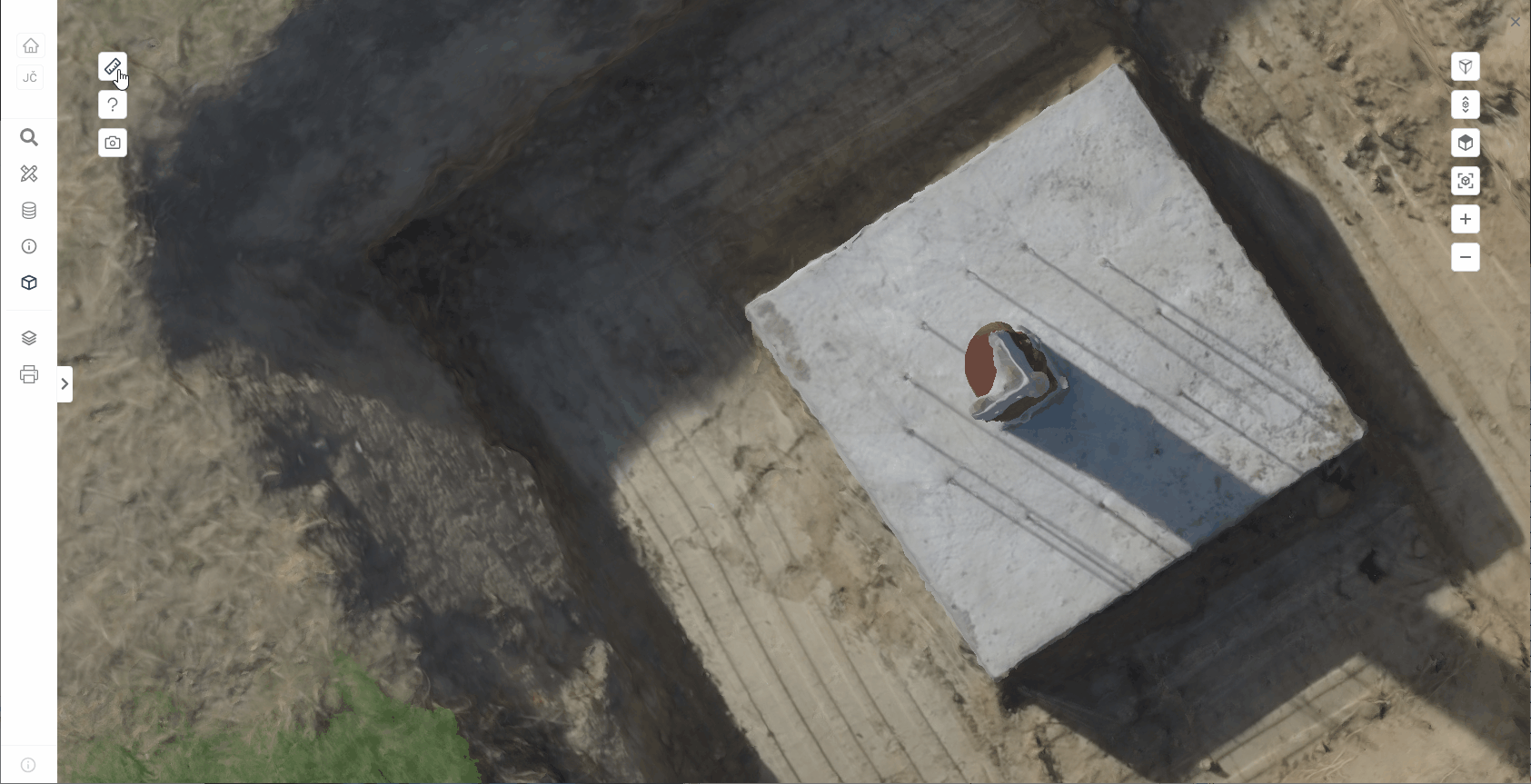
The plotting of points is described in detail in the parent chapter 9.2.
The area measurement uses the coordinate measurement function 9.2.1 and the distance measurement function 9.2.2.
The export of coordinates and measurement results is described in chapter 9.3.
The area of the polygon cannot be calculated and closed if there is a line crossing.
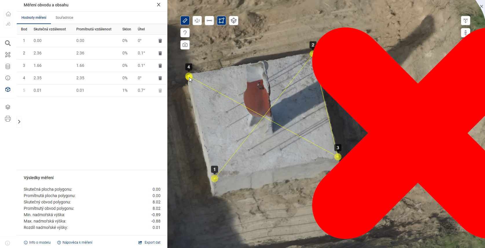
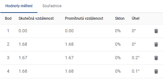
MEASUREMENT VALUES
The table Measurement values shows the calculations for each measurement point.
-
Actual distance = the distance corresponding to the link between this point and the previous point. In the case of the first point, the value 0 is given.
-
Projected distance = the distance corresponding to the length of the horizontal overhang (with angle 0°) in an imaginary triangle, where this point represents the vertex between the overhang and the horizontal overhang. The previous point then represents the vertex between the hypotenuse and the vertical suspension (with an angle of 90°). In the case of the first point the value 0 is given.
-
Slope = standard calculation of the slope of the line joining this point and the previous point, given in whole percent.
-
Angle = the angle between the line (this point - previous point) and the horizontal plane, given in degrees.
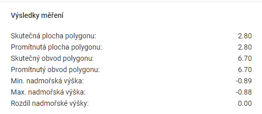
MEASUREMENT RESULTS
The Measurement Results table shows the summary data calculated for the measurements.
-
Real polygon area = polygon area in 3D space.
-
Projected polygon area = the area of a 2D polygon that is the orthogonal projection of a 3D polygon onto a horizontal surface.
-
Real polygon perimeter = the sum of the lengths of all sides of the polygon in 3D space.
-
Projected polygon perimeter = the perimeter of a 2D polygon that is the orthogonal projection of a 3D polygon onto a horizontal surface.
-
Min. altitude = the point with the lowest coordinate value on the Z axis.
-
Max altitude = the point with the highest coordinate value on the Z axis.
-
Difference in altitude = difference between Max. altitude difference between Min. and Min. altitude.